
One moment we were in mystic Milford Sound, and two hours later we were in farmland suited up with four light sources and headed into the limestone Clifden Caves.

The entry and exit points for this underground cave are only 300 meters apart, but it’s a 1-mile scrabble in, over, around, and through a muddy underground maze to make it out. Here’s the craziest part…this is an unguided, DOC-sponsored trail with nothing more than reflector arrows pointing us in the direction of seemingly impossible passages.


This trail would never exist in the US. We spent over an hour underground and were the only people around. I was praying for no earthquakes and no flash floods. And trust me, you do not want to fall in the muddy cave pools...which I almost did. By far, this felt more adventurous and adrenaline-pumping that any paid activity we’ve done in New Zealand.

A couple of hours east are The Catlins, a rugged coastal area that boasts some of the best wildlife in the country. It was a return to the beautiful rolling farmland we experienced in the North Island.

The roads here are lined with flax plants, and the trees are famously sculpted sideways by the intense winds.

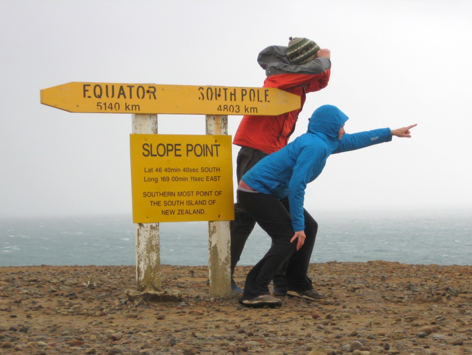
New Zealand controls a handful of islands between their mainland and Antarctica. These islands are nicknamed the Roaring Forties because of their latitudinal position and because they’re the only obstacles in the way of the gale-force winds that blow through that area.
We experienced the Roaring Forties winds firsthand when we spent the night camping at Slope Point, the most southern point on New Zealand’s mainland. Our poor campervan took the brunt as it rained sideways and rocked us to sleep the entire night. The next morning we braved our way down to the point where we were only 4,803 kilometers from the South Pole.
Our favorite stop in The Catlins was at Curio Bay, where a 170-million year old petrified forest appears on the beach at low tide. It’s crazy…there are logs and stumps encased in the tidal shelf that look just like wood. They are brown and you can see the tree rings, but when you touch them, they are definitely stone.

Like clockwork from 6:00-8:00pm at Curio Bay, a series of yellow-eyed penguins pop out of the water and perform a waddle / hop combo up the forest of petrified stumps to their nests in the bush.

Yellow-eyed penguins are the world’s rarest penguin species and are only found in southern New Zealand. They’re also considered the most ancient of all living penguins and are endangered. They were bigger than we expected – the third largest penguin species after the Emperor and the King.

In the summer there are also miniature dolphins that swim and play with people right along the shore. We were too early in the year to see them, but in short, this is a really cool place.

The South Island’s South Coast is such a gorgeous area of the country that we got to see firsthand on several hikes at Tunnel Beach, the Lovers Leap & Chasm Loop on the Otago Peninsula, and Nugget Point.


Dunedin is the South Island’s second biggest city, and architecturally, is much more interesting to look at than anywhere else in New Zealand. While in Dunedin we paid a visit to Baldwin Street, the world’s steepest street. The slope is 19 degrees, but it looks more like 45. There was no way we could take Vanna White up that thing, so we walked it instead. It took us a lung-busting 3.5 minutes to trudge to the top where a water fountain rewarded our efforts.

North of Dunedin are two treasure troves that we could have spent an entire day exploring. At low tide, the tidal shelf along Shag Point is just littered with rock formations that look like dinosaur eggs.

Some are just hatching from the cliff walls.

Some are halfway eroded mermaid hot tubs.

Others are all gone now but have left behind the most perfect natural aquariums.

In 7th grade science class I made a 3D cross-section model of a cell. I'm telling you, this looked just like it. Mother Nature has the funniest way of delighting us.

Finding this place is really ghetto. You have to get to house #183, go through their side gate, and then slide down the mud embankment to the tidal shelf. Shag Point should be right up there with the top sights to see in New Zealand, but instead, we were the only people along the entire beach with the exception of two spear fishermen.

Equally as neat but in their own way, the Moeraki Boulders lie just down the road. It looks like a giant dumped his bag of marbles out on the sand.

These perfectly spherical boulders were formed 55 million years ago when limestone deposited slowly and evenly around shell and plant matter lying on the sea floor. The boulders used to be encased in the mudstone cliffs, but as the cliffs started to erode, out popped the boulders!

When we first started our New Zealand road trip, we weren’t even sure if we’d make it down to this section of the country. We’re so glad that the timing worked out, because this will go down as one of our favorite areas. Every day we saw something we had never seen before. New Zealand’s South Coast is full of surprises.

No comments:
Post a Comment